
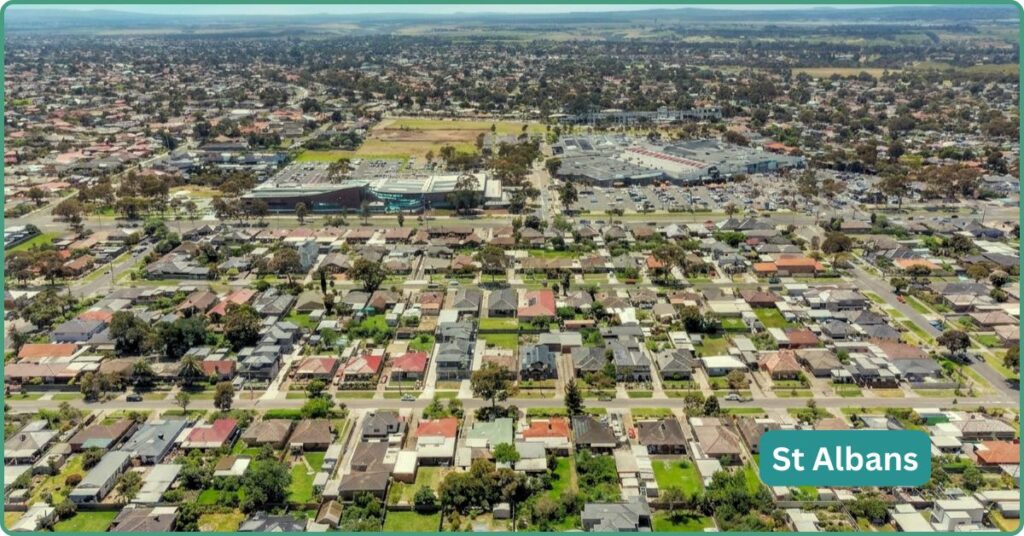
St Albans was Little Malta before it was anything else, a suburb built by 1950s and 60s Maltese, Yugoslav and Italian migrant families on cheap land near a railway line. Today fewer than a third of residents were born in Australia, and Vietnamese-born residents outnumber Malta-born residents nearly eight to one. The Maltese heritage hasn’t disappeared, it’s baked into the street layout and the local church buildings, but the suburb’s lived identity has moved on, and Main Road’s Vietnamese food strip is now the thing most people actually come here for. Don’t expect a settled, high-growth market; St Albans is slow-moving and unglamorous on paper, but it’s also home to Sunshine Hospital (despite the name) and sits directly on a Sunbury line now boosted by Metro Tunnel frequencies.
Boundary Map
St Albans sits roughly 17km north-west of the Melbourne CBD in the City of Brimbank, a substantial 13km² suburb bordered by Keilor Downs to the north, Kealba and Sunshine North to the east, Albion and Cairnlea to the south, and Kings Park to the west. Deer Park sits just beyond Cairnlea and Albion and is commonly cross-shopped against St Albans despite not directly adjoining it.
Quick Facts
| LGA | City of Brimbank |
| Median House Price | $696,000-$725,000 (Woodards/YIP cluster, mid-2026), though sources range as wide as $667,000-$800,901 depending on methodology |
| Median Unit Price | $550,000 (CoreLogic-sourced, 12 months to mid-2026), up around 5.5% year-on-year |
| Population | 38,042 (2021 Census), forecast at 38,256 for 2023; slow growth, up just 1.96% between 2016 and 2021 |
| Growth Rate | Modest and demographic-churn driven, not a growth-corridor suburb; forecast working-age population up ~10% by 2031 |
| Transport | St Albans station (Sunbury line) delivered and rebuilt in 2016; Metro Tunnel boosted frequencies live from February 2026 |
| Crime Rate (LGA) | Brimbank LGA recorded 18,798 offences (most recent period); St Albans itself logged the highest suburb count in the LGA at 4,066 offences |
| Childcare Availability | Multiple established services (long day care, kindergarten, OSHC); supply pressure likely lower than in growth-corridor suburbs given slow population growth |
| Zoned School | St Albans Secondary College (government, Years 7-12); Catholic Regional College St Albans (parish-based intake, Years 7-10) |
| Best For | Value-focused buyers wanting rail access and an established, deeply multicultural food and retail scene; less suited to those chasing rapid capital growth |
Our Verdict
If you’re chasing fast capital growth, St Albans has a genuinely mixed track record, one property-marketing source frames it as a long-term “catch-up” opportunity, another names it among Melbourne’s least favourable investment prospects, and neither claim comes from a primary data provider, so treat both with scepticism rather than picking a side for you. If what you actually want is a well-connected, deeply established, genuinely affordable suburb with one of Melbourne’s best Vietnamese food precincts and a hospital on your doorstep, St Albans delivers that without much argument.
It suits value-focused first-home buyers and long-term holders who don’t need to flip quickly, renters and downsizers who want train access without inner-suburb prices, and anyone who wants to live inside a suburb where the food and retail scene is a genuine daily asset rather than an occasional novelty. It’s a weaker fit for investors chasing near-term capital growth, given the conflicting evidence on that front. For those who specifically want the Maltese-community character the suburb is historically known for, that community and its buildings remain part of the fabric, but the suburb’s lived, day-to-day identity has moved on substantially.
Weighed against its closest neighbours, the trade-offs are fairly clear. Sunshine, just south-east and also on the Sunbury line, is the more obvious like-for-like comparison, similarly multicultural, similarly benefiting from Metro Tunnel upgrades, but positioned by some commentary as “improving faster.” Deer Park, further south-west, appeals to buyers wanting more green space and a broader housing mix, but has historically shown limited capital growth and carries high stock-on-market levels without matching price pressure. St Albans sits below both on price in most readings and holds its own on transport and food-scene strength, which is exactly the trade a value-focused buyer here is making.
St Albans Backstory: Heritage & Origins
St Albans was subdivided as a township in 1887 by the Cosmopolitan Land and Banking Company during the era’s speculative land boom, with the railway station opening the same year. The name itself has an unlikely origin story: company manager Alfred Padley reportedly requested “St Albans” because his mother’s family had a centuries-old association with St Albans Abbey in Hertfordshire, England.
The suburb’s real transformation came after WWII. Through the 1950s, St Albans grew from roughly 900 to 7,000 people, driven by a wave of Yugoslav, Maltese and Italian migrant families drawn by cheap land near a railway line and close to factory work, facilitated in part by the 1948 Malta-Australia Assisted Passage Agreement. St Albans and neighbouring Sunshine became known as “Little Malta” from the 1960s onward, and Victoria still holds the largest Maltese-born population of any Australian state as a legacy of this migration wave.
The St Albans Village Plan Heritage Area, a council-recognised heritage precinct, preserves the suburb’s unusual circular 19th-century street layout designed by architect Percy Oakden, along with buildings including the Albans Uniting Church, a circa-1890 house on the original estate, St Albans Public Hall (1956) and St George’s Free Serbian Orthodox Church (1954-1964).
Today just 32.5% of St Albans residents were born in Australia, Vietnam (21.5%) is now by far the largest overseas birthplace, and Malta-born residents (2.7%) make up a small fraction of what they once did. The heritage is real and preserved; the lived community has substantially moved on.
Future Development
The suburb’s single biggest infrastructure story is actually already over: the Furlong Road and Main Road level crossings were removed by lowering the rail line below both roads, with trains running in the new alignment since 1 November 2016. That project also delivered the rebuilt, below-ground St Albans station and a new Ginifer station nearby.
The more current growth story is town-centre renewal rather than transport construction. Brimbank Council adopted the Go St Albans Place Management Framework 2025-2030 in December 2025, a five-year plan aiming to position St Albans Town Centre as one of Melbourne’s most dynamic multicultural destinations by 2030. This sits alongside the St Albans Activity Centre Precinct Structure Plan, the strategic document that will shape future development approvals in the activity centre, and the Errington Precinct Master Plan, which sets direction for a community-space redevelopment.
Treat all three as planning frameworks setting direction, not confirmed construction projects with dates attached. A St Albans Leisure Centre Replacement is also referenced as a live council project, though its timeline and funding weren’t confirmed at the time of writing. On transport, the real near-term win landed in February 2026: the Sunbury line, which serves St Albans, now runs exclusively through the Metro Tunnel, delivering more than 1,000 new weekly services and peak frequencies of every 5-10 minutes, a genuine, already-delivered upgrade rather than a future promise.
Transport
St Albans station sits on the Sunbury line, 17.81km from Southern Cross by rail, a below-ground station following its 2016 rebuild. Since the Metro Tunnel’s full switch-over in February 2026, the Sunbury corridor runs with genuinely metro-style frequencies, a material upgrade for anyone commuting from here. Neighbouring stations Ginifer and Albion sit on the same line.
Bus route 408 runs between Highpoint Shopping Centre, Sunshine Station and St Albans Station, and notably stops directly in front of Sunshine Hospital’s emergency department; other routes reportedly serve the St Albans Station precinct but should be checked directly via Transport Victoria’s journey planner for current frequency and endpoints.
By road, St Albans Road runs past the station, with Furlong Road and Kings Road as other key arterials. The Kings Road/Calder Highway interchange, a $62 million project, opened back in January 2012, connecting the area to the Calder Freeway..
Crime and Safety, Honestly
Victorian crime data is published at council level. Brimbank LGA recorded 18,798 offences in the most recent reporting period, up 1.5% on the year before, a slower rise than the state average at that point. Within the LGA, St Albans recorded the highest suburb-level count at 4,066 offences, ahead of Sunshine (3,284), Deer Park (1,540), Sunshine North (1,357) and Taylors Lakes (1,353), an increase of 457 offences on the prior year and enough for local reporting to describe St Albans as the most crime-dense suburb in the municipality. Using the 2023 population estimate of 38,256, that raw count works out to roughly 10,630 offences per 100,000 people, a derived calculation rather than an official published rate, so treat it as indicative rather than a headline statistic. Family violence incidents across Brimbank actually fell 7.7% over a recent 12-month period and now sit below the state average, a genuinely positive counterpoint worth knowing.
Schools and Childcare
St Albans Secondary College is the local government secondary option, Years 7-12. Catholic Regional College St Albans covers Years 7-10 only (students move to other CRC federation campuses for Years 11-12) and runs on parish-based intake rather than a standard geographic zone, drawing from four named parishes across St Albans, St Albans South, Kings Park and Kealba, a genuinely different enrolment system worth understanding if you’re weighing government versus Catholic schooling here. No independent school ranking data was confirmed for either school in current research.
Childcare supply looks reasonably established: named services include St Albans Early Learning Centre, Acacia Children’s Centre (rated Exceeding NQS), a newly-approved St Albans West Kindergarten, and an OSHC service at St Albans Meadows Primary School. Given the suburb’s slow population growth compared to genuine growth-corridor suburbs, supply pressure here is plausibly lower than elsewhere in Melbourne’s west, though that’s a reasoned inference rather than a directly sourced fact.
Hospitals and Healthcare
Here’s a genuine correction to how this suburb usually gets described: Sunshine Hospital isn’t just “nearby,” its street address, 176 Furlong Road, is physically inside St Albans, despite carrying the neighbouring suburb’s name. It’s a public teaching hospital run by Western Health, one of three major hospitals the network operates in Melbourne’s west, offering emergency, women’s and children’s, surgical, medical, aged care and rehabilitation services. The Peter MacCallum Cancer Centre also runs a Sunshine campus co-located with the hospital. Bus route 408 stops directly in front of the emergency department, a genuinely useful detail for anyone without a car.
Parks, Attractions & Fitness
Errington Reserve, on Main Road East, is the suburb’s standout green space: an oval, playground, free tennis and basketball courts, a BBQ and picnic area, a community centre, a skate park, and Alice’s Playspace, an all-abilities inclusive playground that opened in 2013. Brimbank Council maintains further parks and playgrounds across the suburb beyond Errington Reserve. St Albans Football Club competes in the Essendon District Football League, giving the suburb a real organised-sport presence.
Just outside the suburb to the north in Keilor Downs is the new Brimbank Aquatic and Wellness Centre offering a two-level 24/7 gym, an Olympic-sized swimming pool, two water slides, spa, steam room and sauna along with training rooms for group fitness such as pilates, yoga etc.
Shopping and Dining
The St Albans Town Centre, centred on Main Road West, Main Road East and Alfrieda Street, is a dense cluster of ethnic speciality grocers, Vietnamese restaurants, bakeries and bubble tea shops alongside some mainstream retail. This is arguably the suburb’s biggest daily-life asset: independent guides brand St Albans as one of Melbourne’s most multicultural western suburbs, and the concentration of Vietnamese dining along Main Road is genuinely well-regarded, with named venues including Cafe 286 and Dong Ba 2 among a much larger strip of options. The food scene here is a real reason to choose St Albans over a suburb with less retail character.
What It’s Actually Like to Live Here
St Albans is a suburb whose Census data tells a genuinely striking migration story. Just 32.5% of residents were born in Australia, and Vietnam (21.5%) is now the dominant overseas birthplace, well ahead of India (5.8%), the Philippines (3.0%) and Malta (2.7%). The historic “Little Malta” identity hasn’t vanished, the heritage buildings and community remain, but it’s been substantially demographically superseded by more recent Vietnamese and broader Asian migration.
Owner-occupancy sits at 59.1%, down slightly from 60.5% in 2016, a modest drift toward renting over that period. Median weekly household income ($1,205) and median rent ($325) are both dated to the 2021 Census and will be understated relative to current figures. The suburb carries a lower relative socio-economic ranking on standard indices, consistent with its affordable price positioning. This is a mature, largely built-out suburb where growth comes from demographic churn and infill rather than new housing supply, not a fast-changing growth-corridor story.
Trade-offs
Investment commentary on St Albans is genuinely contradictory, one source frames it as an undervalued land-banking opportunity, another names it among Melbourne’s least promising suburbs for investors, and neither is a primary data source, so don’t lean on either claim without your own due diligence. House price figures themselves vary by as much as $134,000 depending on the source, a wider-than-usual spread suggesting real volatility or thin transaction volumes at points in the market. St Albans carries the highest raw crime count of any suburb in the Brimbank LGA, worth weighing honestly even though the population-adjusted rate is a derived estimate rather than an official figure. And if you’re drawn here specifically for the historic Maltese-community character, know that the demographic reality today is dominated by more recent Vietnamese and broader Asian migration, the heritage remains in the built fabric, not in the day-to-day community makeup.
FAQ
What are property prices like in St Albans? House medians cluster around $696,000-$725,000 (mid-2026), though sources range as wide as $667,000 to $800,901 depending on methodology. Units sit around $550,000, up roughly 5.5% year-on-year.
Does St Albans have a train station? Yes. St Albans station sits on the Sunbury line, rebuilt below-ground in 2016, and now benefits from Metro Tunnel-boosted frequencies (every 5-10 minutes at peak) since the February 2026 network switch-over.
Is St Albans safe? Crime is reported at the Brimbank council level. St Albans recorded the highest suburb-level offence count in the LGA (4,066) in the most recent reporting period. A precise population-adjusted rate is a derived estimate (roughly 10,630 per 100,000), not an official published figure.
What are the best schools zoned for St Albans? St Albans Secondary College is the local government option (Years 7-12). Catholic Regional College St Albans covers Years 7-10 on a parish-based intake system rather than a standard geographic zone.
References
- Australian Bureau of Statistics. 2021 Census All Persons QuickStats, St Albans (SAL22330); 2016 Census comparison figures.
- forecast.id / profile.id, City of Brimbank. Population forecasts and profile data for St Albans.
- Crime Statistics Agency Victoria. Offence data via Star Weekly (Brimbank & North West edition) reporting.
- Victoria’s Big Build, Department of Transport and Planning. Furlong Road, St Albans level crossing removal project pages.
- Transport Victoria. Sunbury Line and Metro Tunnel service update pages.
- Brimbank City Council. Go St Albans Place Management Framework 2025-2030; St Albans Activity Centre Precinct Structure Plan; Errington Reserve and parks directory.
- Victorian Heritage Database. St Albans Village Plan Precinct.
- St Albans History Society. “The other St Albans.”
- Museums Victoria. Immigration History from Malta to Victoria.
- Western Health. Sunshine Hospital; Peter MacCallum Cancer Centre Sunshine campus.
- Directory of Catholic Education Victoria. Catholic Regional College St Albans.
- Victorian Department of Education. St Albans Secondary College.