
Melbourne’s Eastern Region stretches from the leafy inner-suburban fringe of Whitehorse and Manningham all the way out to where the city stops pretending to be a city and becomes something else entirely: wine country, mountain villages, steam-train territory, and one of Australia’s great wildlife sanctuaries. Six local government areas make up the region: the City of Manningham, City of Whitehorse, City of Knox, Yarra Ranges Shire, City of Maroondah, and City of Monash. Together they cover a range of landscapes and experiences that takes most Melburnians years to fully appreciate.
You can eat your way through some of Australia’s most exciting Asian food in Box Hill or Glen Waverley, hike Melbourne’s most popular rainforest trail before 8am, board a 100-year-old steam train in Belgrave, and pull up to a Yarra Valley cellar door before the city crowd arrives. The eastern suburbs reward people who are curious enough to go past the first ring road.
Melbourne Eastern Region Map
Eastern Region Legend
City of Manningham: Rivers, Ridgelines and a Gold Rush Village
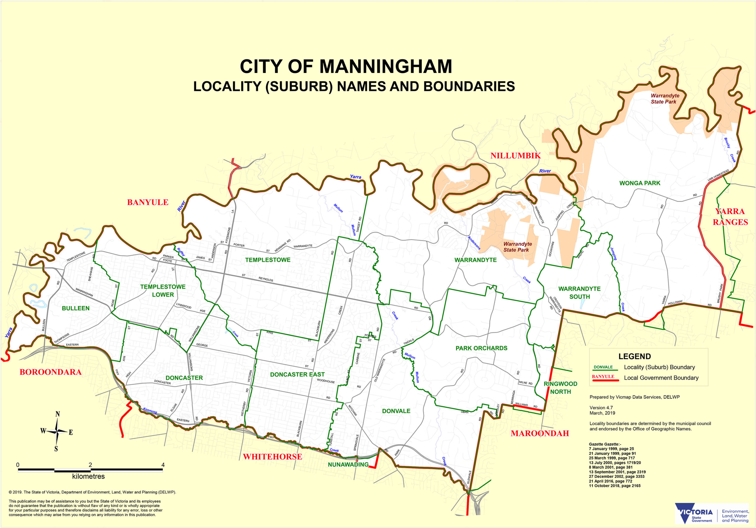
Manningham sits in Melbourne’s north-east, running from the Doncaster ridgeline down to the Yarra River and out through undulating valleys towards Warrandyte’s semi-rural fringe. It is one of the greener LGAs in the metropolitan area, with more than 300 parks and reserves packed into 113 square kilometres. The catch: no train lines, no trams. Manningham travels by car, which gives it a quieter, more self-contained character than its neighbours.
Doncaster is the commercial heartbeat, with Westfield Doncaster sitting prominently on the ridgeline above the Eastern Freeway. But the suburb that earns its own chapter is Warrandyte. Head out there on a Sunday morning and you’ll find a Yarra River township that operates at a resolutely unhurried pace: galleries, cafes with verandahs, riverside walks, and the kind of main street where people actually know each other. It’s 25 kilometres from the CBD and feels like a different world.
Warrandyte also carries significant historical weight. It is the site of Victoria’s first gold discovery (at Andersons Creek in July 1851), the event that ignited the great Victorian gold rush. Warrandyte State Park preserves that history in remarkable physical form: walk the Gold Heritage Trail and you’ll pass through the actual mine shafts, stopes (underground slots where reef gold was extracted), and ruins that remain from when 250 miners worked this ground at the turn of the 20th century. The Fourth Hill Gold Memorial marks the precise spot. It’s one of the most underrated historical walks in metropolitan Melbourne, and almost nobody from the western suburbs knows it exists.
Templestowe, immediately to the west, offers a different outdoor experience: Westerfolds Park follows the Yarra River through stands of river red gum and provides excellent walking and cycling with city skyline views on clear days. Ruffey Lake Park in Doncaster is a year-round bird-watching favourite.
| Suburb | Character | Distance from CBD |
|---|---|---|
| Doncaster | Commercial hub, Westfield, family residential | 16 km |
| Doncaster East | Quiet residential, schools, parkland | 19 km |
| Templestowe | Elevated, leafy, Yarra river access | 18 km |
| Warrandyte | Gold-rush village, Yarra River, state park | 25 km |
| Donvale | Quiet, generous blocks, park access | 21 km |
| Bulleen | Inner-fringe, Yarra access, light industrial mix | 10 km |
Getting there: SmartBus routes 901 and 906 connect Doncaster to the train network and the CBD. The 907 links to Box Hill. By car, the Eastern Freeway delivers you to Doncaster in around 20 minutes from the city (outside peak hour).
City of Whitehorse: Box Hill and the Best Dumplings East of the CBD
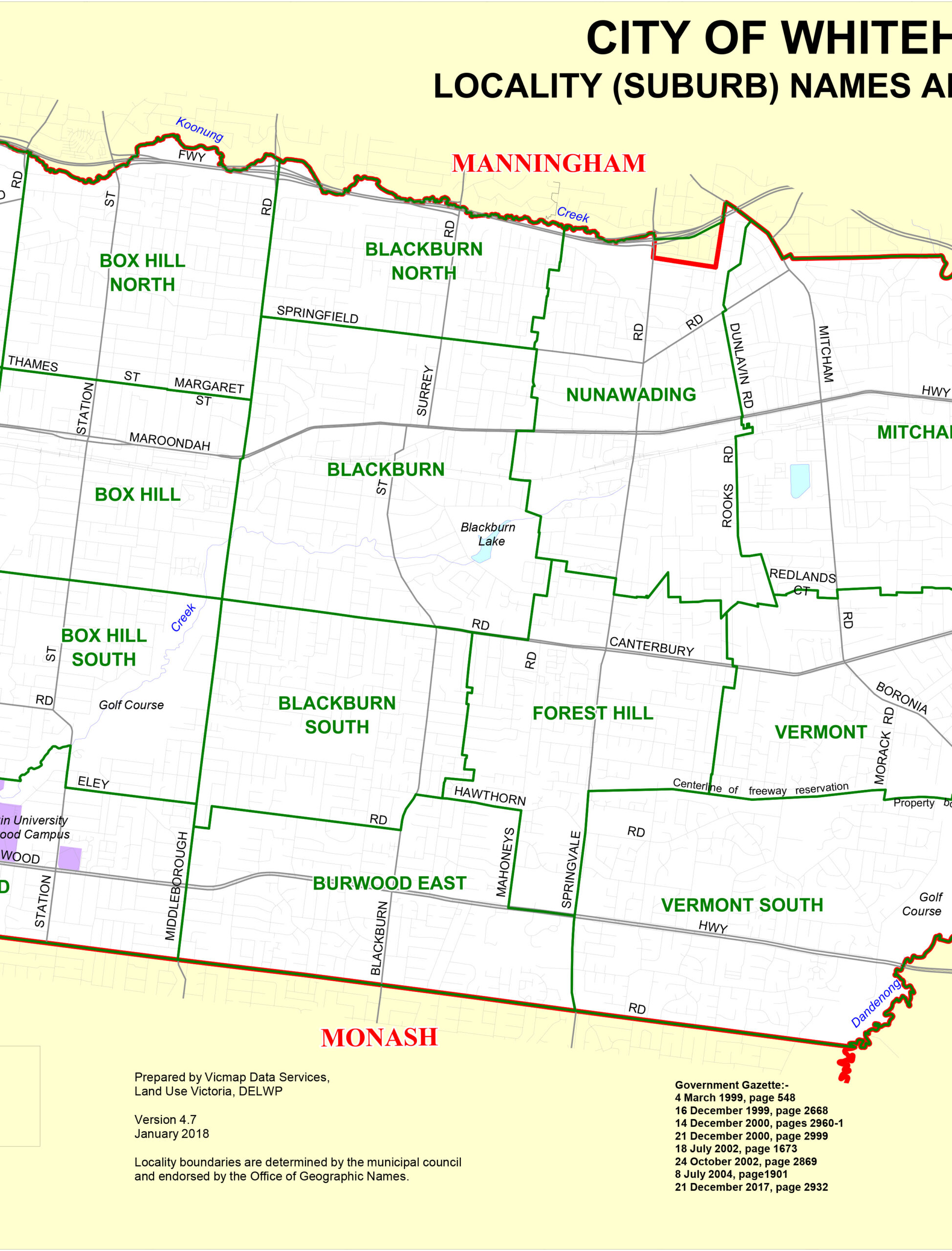
Whitehorse is 15 kilometres east of the CBD, 64 square kilometres, and home to one of the most exciting eating destinations in Australia. That destination is Box Hill, and if you have not spent a lunchtime there, you are missing something genuinely special about Melbourne.
After the dismantling of the White Australia Policy in the 1970s, Box Hill’s affordable housing attracted migrants from China, Vietnam, Malaysia, Korea and Thailand. Today, over a third of Box Hill’s residents have Chinese ancestry, making it Melbourne’s de facto second Chinatown. Whitehorse Road through Box Hill Central is lined with Sichuan hotpot restaurants, Korean barbecue joints, Vietnamese pho shops, Taiwanese hawker stalls, ramen bars, dim sum teahouses and bubble tea outlets. The food court at Box Hill Central (directly above Box Hill station) is a Melbourne institution: arrive by 11:30am before the queues build. Sky One Plaza brings major international names, including Haidilao hot pot chain and the cult-favourite Molly Tea among them, into a sleek, purpose-built dining and retail precinct.
Box Hill is not just a food suburb. It is also the eastern-suburbs transport hub: the Belgrave, Lilydale and Alamein train lines all terminate or pass through here, along with a major SmartBus interchange. A future Suburban Rail Loop station will embed Box Hill even more deeply as the commercial and civic centre of Melbourne’s east.
The rest of Whitehorse offers a gentler pace. Blackburn is one of metropolitan Melbourne’s most pleasant residential suburbs: the Blackburn Lake Sanctuary (a 25-hectare protected bushland remnant with birdlife-rich wetlands right in the middle of suburbia) is worth an hour of anyone’s time. Mont Albert’s tree-lined streets of Federation-era homes lead to a cafe strip that is, quietly, one of the nicest in the eastern suburbs. Burwood Highway south of the Box Hill boundary carries an excellent stretch of Thai and Vietnamese restaurants for those who prefer eating without the crowds.
| Suburb | Character | Distance from CBD |
|---|---|---|
| Box Hill | Multicultural dining hub, transport interchange | 15 km |
| Blackburn | Leafy village, lake sanctuary, schools | 17 km |
| Nunawading | Commercial, light-industrial, train access | 19 km |
| Mitcham | Quiet residential, freeway access | 22 km |
| Vermont | Established family suburb, good schools | 22 km |
| Mont Albert | Heritage homes, cafe strip, character streets | 12 km |
| Burwood | University, Asian dining, Burwood Highway | 14 km |
| Forest Hill | Suburban residential, Forest Hill Chase | 20 km |
Getting there: Belgrave, Lilydale and Alamein lines all serve Box Hill station directly from Flinders Street. Journey time is around 25 to 30 minutes. Mitcham, Nunawading and Blackburn are served by stations on the same corridor.
City of Knox: Foothills, the Famous 1000 Steps and Family-Focused Suburbs
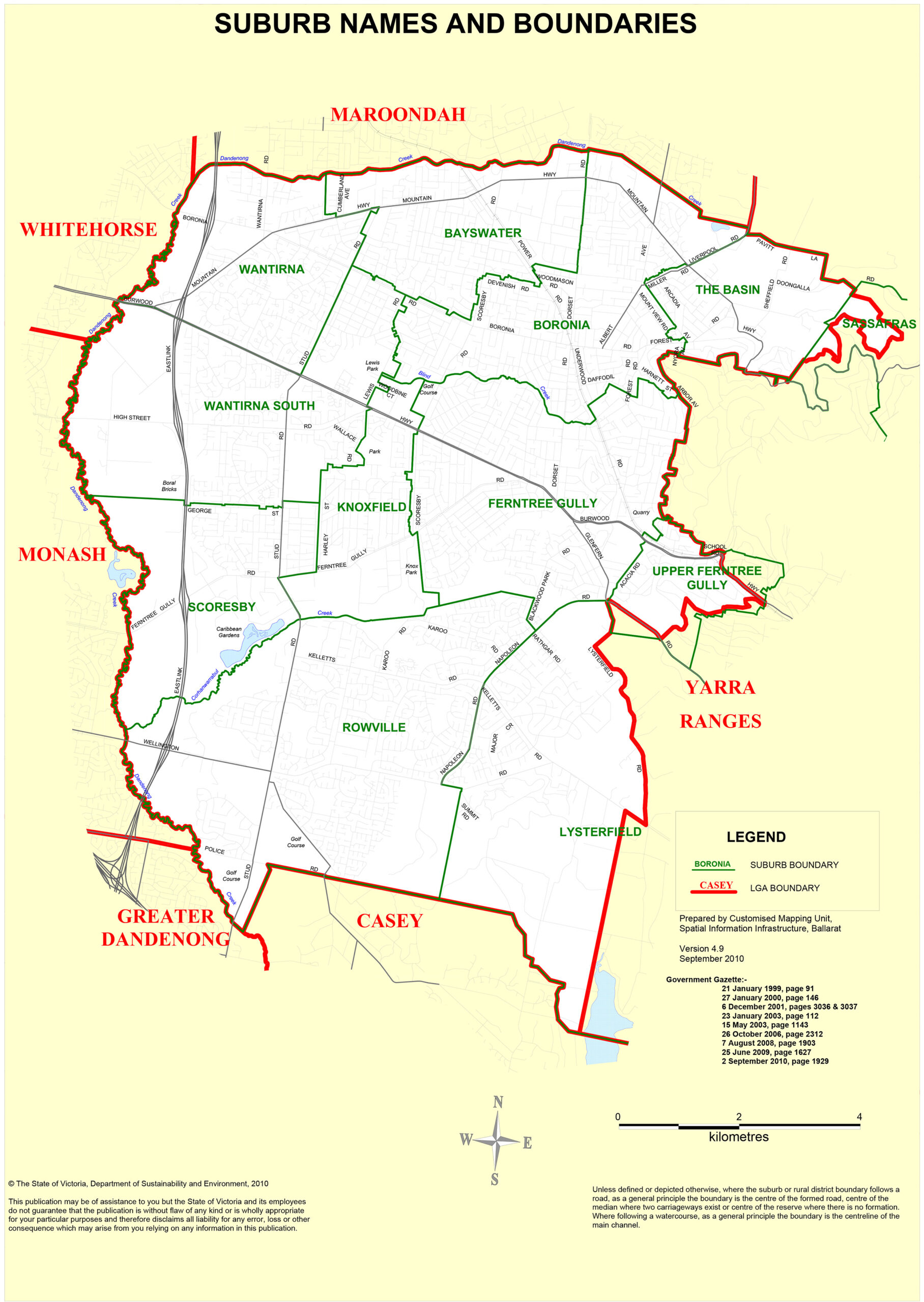
Knox is where Melbourne’s outer-suburban fabric starts to feel the pull of the Dandenong Ranges. The LGA’s western end (Wantirna, Rowville) is polished family suburbia with good schools and shopping. Its eastern edge (Upper Ferntree Gully, The Basin) is something different: trailhead country, where the mountain begins and the city finally runs out of road.
The centrepiece of Knox’s visitor appeal is the Kokoda Track Memorial Walk (universally known as the 1000 Steps). Melbourne’s most popular bushwalk departs from Ferntree Gully Picnic Ground, near Upper Ferntree Gully station on the Belgrave line, and climbs steeply through a corridor of mountain ash and tree-fern rainforest. Fourteen plaques along the route honour Australian Military Forces who fought and died on the Kokoda Track in Papua New Guinea during World War II. The similarity of the terrain to the actual Kokoda Track inspired veterans to adopt the site as their memorial in 1998. The walk covers around three kilometres, gains 287 metres of elevation, and takes most people 1.5 to 2 hours. Go before 9am: locals are already there by 7am, and it is genuinely crowded by mid-morning on weekends.
Boronia is the commercial and transit anchor for Knox’s middle ring: the town centre has a solid range of everyday amenities and the Boronia station sits on the Belgrave line. Wantirna South is home to Knox City shopping centre, the LGA’s major retail hub. Rowville, in the south, is one of Knox’s newer residential areas with large family homes and the Stud Park shopping centre.
Upper Ferntree Gully and The Basin sit at the very edge of the Dandenong Ranges National Park, giving residents (and day-trippers) near-immediate access to serious bushwalking territory beyond the 1000 Steps, including trails into the national park itself and connections to the Lysterfield Lake Park mountain biking network.
| Suburb | Character | Distance from CBD |
|---|---|---|
| Wantirna | Family residential, Knox City shopping | 24 km |
| Bayswater | Residential, light industrial, Belgrave line | 26 km |
| Boronia | Local commercial centre, train access | 28 km |
| Rowville | Newer residential, large homes, good schools | 28 km |
| Ferntree Gully | Ranges gateway, Dandenong National Park access | 30 km |
| Upper Ferntree Gully | 1000 Steps trailhead, semi-rural, Belgrave line | 33 km |
Getting there: Belgrave line serves Boronia, Ferntree Gully and Upper Ferntree Gully stations. The EastLink toll road provides fast car access from the CBD (approximately 35 minutes). Free parking is available at the Ferntree Gully Picnic Ground for the 1000 Steps walk.
Yarra Ranges Shire: Steam Trains, Sanctuary Wildlife and Wine Country
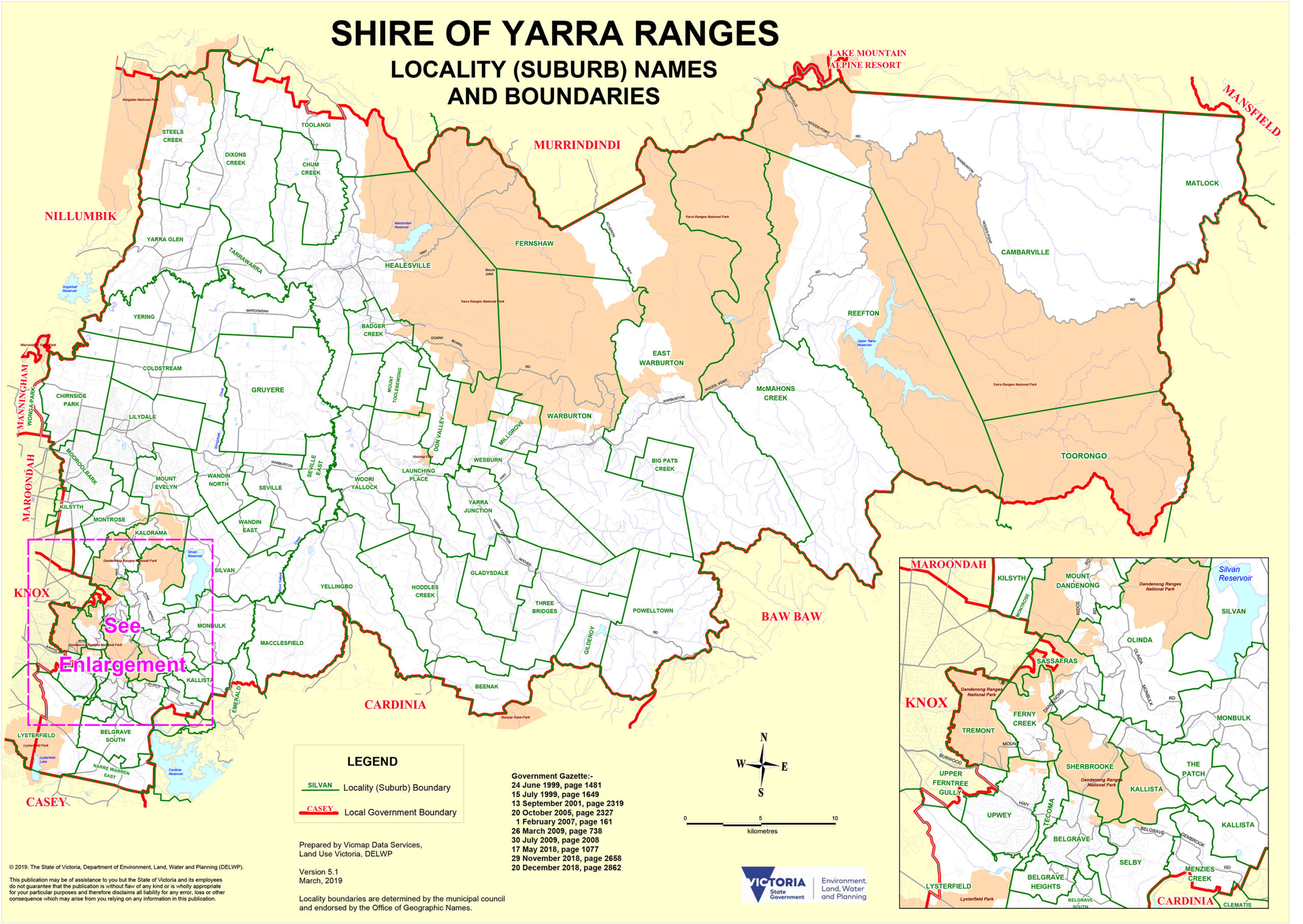
Beyond Knox, metropolitan Melbourne releases its grip and the Yarra Ranges takes over. This is the Eastern Region’s great outdoors: a vast shire that runs from the suburban western gateway of Lilydale east through wine country, national park, rainforest, and on into alpine foothills. It is enormous in scope and exceptional in what it delivers for day-trippers and weekend visitors from Melbourne.
Lilydale is the practical starting point. The Lilydale train line from Flinders Street terminates here, making it the transit gateway to the entire valley. The lake, the historic main street, and the surrounding farmland set the tone for what lies ahead.
Head east from Lilydale into the Yarra Valley and the agenda becomes serious. The Yarra Valley is Victoria’s oldest wine region, with Yering Station (established 1838) holding the distinction of being the state’s first vineyard. Today, more than 70 cellar doors are clustered around the towns of Coldstream, Yarra Glen and Healesville, specialising in cool-climate Pinot Noir, Chardonnay and world-class sparkling wines. Arrive before 11am on a weekend morning and you will have cellar doors largely to yourself. By noon, the car parks tell a different story.
Healesville is where the valley reaches its dining and cultural peak. The main street along Maroondah Highway has evolved into a genuine food destination: farm-to-table cafes, destination restaurants, and producers selling their goods directly. Healesville Sanctuary, operated by Zoos Victoria, sits on the edge of town in 70 acres of enclosed bushland. It specialises in native Australian animals: koalas, kangaroos, wombats, dingoes, platypus and an extraordinary collection of bird life. The Spirits of the Sky free-flight raptor show (Wedge-tailed Eagles, kookaburras, parrots) is a highlight. The Australian Wildlife Health Centre, a working veterinary hospital treating over 1,500 orphaned or injured wildlife annually, opens its doors to visitors. Head up before 10am: the car park fills fast on weekends, and the morning hours are when the animals are most active. Children under 16 enter free on weekends and school holidays. Open 9am to 5pm, every day of the year.
Yarra Glen offers a different kind of Ranges experience: a small wine-country town with the Grand Hotel Yarra Glen as its social centre (a Victorian-era pub built for long lunches and unhurried afternoons) and some of the valley’s most prestigious estates within easy driving distance, including TarraWarra Estate and the historic Yering Station.
At the southern edge of the shire, Belgrave is the departure point for Puffing Billy Railway. Opened in 1900 as one of five Victorian narrow-gauge lines, Puffing Billy runs 762mm-gauge steam trains from Belgrave through the Dandenong Ranges to Gembrook, a journey of around 24 kilometres through mountain ash forest, fern gullies and rural country. What makes it iconic: the open-sided carriages, where passengers are invited to sit on the wooden edges and dangle their legs over the side as the train rolls through the forest at a pace that gives you time to actually look at the trees. More than 600 volunteers keep the railway running. It operates daily except Christmas Day, and tickets should be booked well in advance for weekends and school holidays.
Up in the Dandenong Ranges themselves, Olinda is a mountain village that repays slow exploration: the internationally recognised Cloudehill Garden, Olinda Falls (a short walk through tree ferns to a lovely cascade), and a collection of tearooms and artisan shops that suit a grey-sky afternoon perfectly. Nearby, in Mount Dandenong, William Ricketts Sanctuary is one of the genuinely unexpected experiences in the greater Melbourne area: a fern-filled bush garden where sculptor William Ricketts spent decades creating 92 major clay works depicting Aboriginal Australian spirituality and connection to country. Entry is free. Open daily 10am to 4:30pm, except Christmas Day and total fire ban days.
| Suburb/Town | Character | Distance from CBD |
|---|---|---|
| Lilydale | Valley gateway, train terminus, Lilydale Lake | 37 km |
| Healesville | Wine and wildlife hub, farm dining, Sanctuary | 58 km |
| Yarra Glen | Wine-country town, grand pub, premium estates | 46 km |
| Mooroolbark | Outer suburban, Lilydale line, family community | 32 km |
| Mount Evelyn | Hilly village character, Upper Yarra Trail | 40 km |
| Belgrave | Puffing Billy departure point, Ranges gateway | 40 km |
| Olinda | Mountain village, gardens, waterfalls, tearooms | 45 km |
Getting there: Lilydale train line runs from Flinders Street to Lilydale (around 60 minutes). Bus routes 685 and 686 connect Lilydale station to Healesville and Yarra Glen. Belgrave train line serves Belgrave directly. The Yarra Valley wineries and Olinda are best accessed by car. Multiple tour operators run day trips from the Melbourne CBD.
City of Maroondah: Ringwood’s Retail Revival and the Ranges Gateway
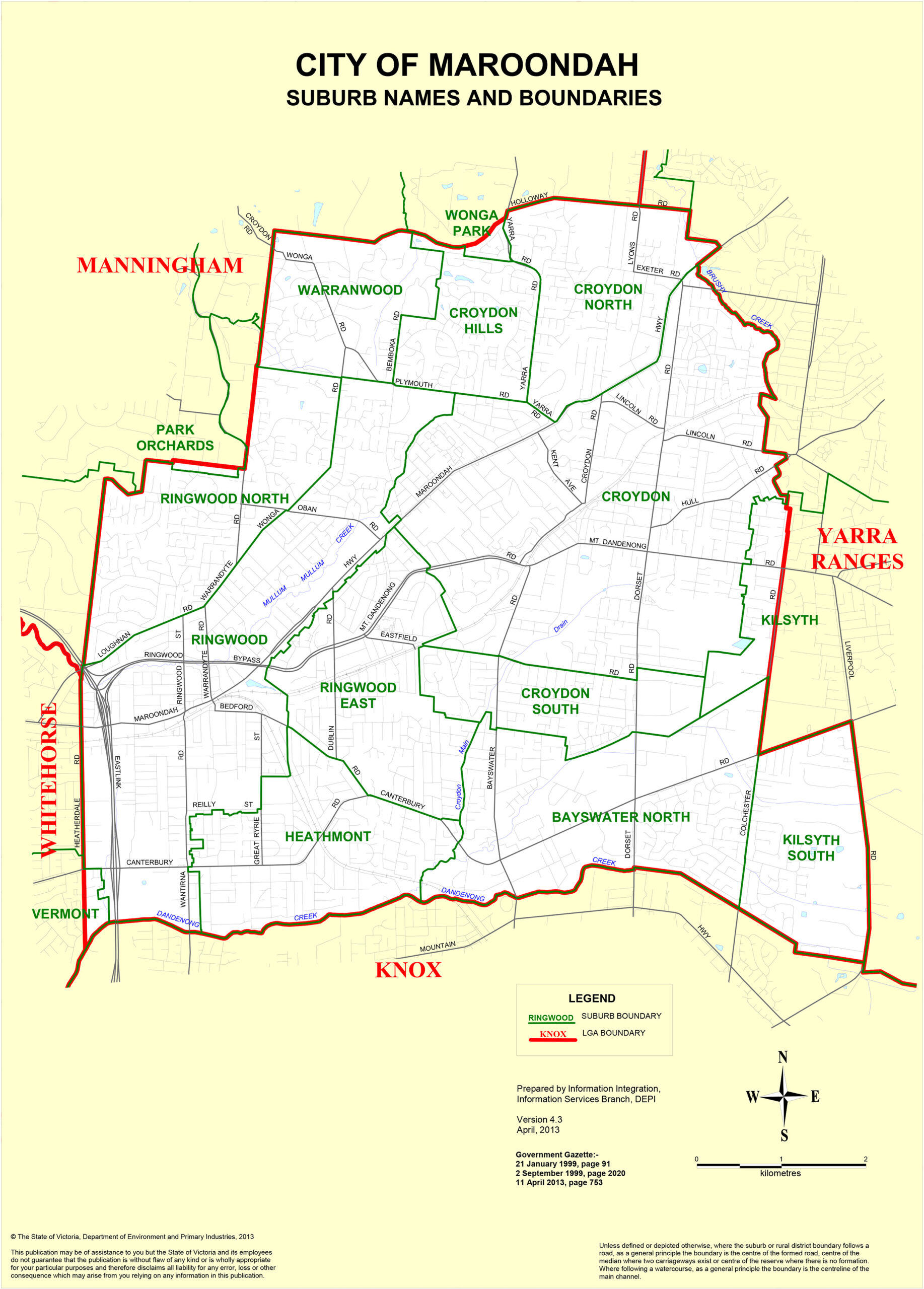
Maroondah is a gateway city in the best sense: positioned at the point where Melbourne’s suburban grid gives way to national park and wine country, it functions as a service and transit hub while quietly building its own identity as a place worth visiting in its own right.
Ringwood is the engine room. For decades it was a fairly unremarkable outer-suburban commercial centre. Then Eastland Shopping Centre underwent a transformation that turned it into the fourth-largest shopping complex in Australia, with more than 340 stores, a 12-screen Hoyts cinema, and the Ringwood Town Square outdoor dining precinct built alongside it. The Town Square is genuinely pleasant on a warm evening: the restaurant line-up is solid, and 400 Gradi, serving award-winning Neapolitan-style pizza, is the standout. Ringwood station sits directly adjacent to Eastland, giving the whole precinct a walkability that most outer-suburban retail hubs lack. Both the Belgrave and Lilydale train lines serve Ringwood, making it a 40-minute train trip from the city.
Croydon, to Ringwood’s north, operates at a lower frequency. It is a large, predominantly residential suburb with a traditional main-street shopping strip, good schools and a settled, family-oriented character. Its station on the Lilydale line connects it efficiently to the city. Heathmont has a quiet village shopping strip on Canterbury Road that is the kind of place locals use and visitors stumble upon with pleasure.
Ringwood Lake Park, tucked alongside Eastland, provides a useful counterpoint to the retail noise: a wetland and picnic park with short walking trails and waterbird activity that is easy to combine with a shopping visit, and entirely free.
| Suburb | Character | Distance from CBD |
|---|---|---|
| Ringwood | Retail hub, Eastland, direct train access | 24 km |
| Croydon | Family residential, Lilydale line, main street | 27 km |
| Heathmont | Village shopping, quiet residential | 26 km |
| Bayswater North | Industrial and residential mix | 27 km |
Getting there: Belgrave and Lilydale lines both serve Ringwood station. Croydon station is on the Lilydale line. The EastLink motorway connects Maroondah directly to the CBD in around 30 minutes by car.
City of Monash: Chadstone, Campus Life and Glen Waverley’s Food Scene
Monash is the south-eastern powerhouse of the Eastern Region, and it operates with considerable ambition. This is the LGA that contains Australia’s largest shopping centre, one of the country’s biggest university campuses, and a dining suburb in Glen Waverley that is slowly building the same culinary reputation that Box Hill has held for a decade. Named after World War I commander Sir John Monash, the LGA has a population of over 209,000 (as of 2024), making it one of the most populous municipalities in Victoria. Fifty-two per cent of residents were born overseas, against a Melbourne average of 29 per cent, and that diversity is very obviously expressed in the food.
Start with Chadstone. The numbers are staggering: 550-plus stores, 20 million visitors a year, the largest car park in Australia (10,000 spaces, free). The store list reads like a global fashion directory: Apple, Sephora, H&M, Uniqlo, Zara, David Jones, Myer, and dozens more. For families, the LEGOLAND Discovery Centre and Hoyts Cinema cover the entertainment brief. Chadstone is 13 kilometres from the CBD. If you are not driving, the free tourist shuttle departs from Federation Square multiple times daily. Open until 9pm Thursday to Saturday, 7pm Sunday. Later opening hours make post-work visits from the city workable. (Have a plan: Chadstone is enormous, and aimless wandering will see you covering the same ground three times.)
Glen Waverley is Monash’s cultural and culinary centre. The town is built around a well-designed commercial precinct leading to Glen Waverley station (terminus of the Glen line from the CBD, approximately 40 minutes). The dining action is concentrated along Kingsway and the surrounding blocks: Dragon Hot Pot on Kingsway for Sichuan-style hot pot built on century-old recipes; Laksa King Kitchen for rich Malaysian-Chinese laksa; Rock Kung for creative Asian small plates; ramen shops, sushi counters and milk-tea specialists filling in the gaps. The density of good food in a relatively compact area rivals Box Hill, and on weeknights the crowds are lighter. Glen Waverley is to Monash what Box Hill is to Whitehorse, and some people think it is even better.
Clayton, adjacent to Monash University’s main campus, plays a complementary role: affordable Asian food in high volume, a student-campus energy, and the Monash Museum of Art (MUMA) for those who want a cultural dimension to their visit. The Jells Park regional reserve in Wheelers Hill and Mulgrave (with a large lake, cycling trails and picnic grounds) rounds out Monash’s outdoor offering.
| Suburb | Character | Distance from CBD |
|---|---|---|
| Glen Waverley | Dining hub, The Glen, Glen line terminus | 22 km |
| Clayton | University campus, student dining, hospital | 19 km |
| Mount Waverley | Family residential, leafy streets, Glen line | 18 km |
| Wheelers Hill | Affluent residential, Jells Park access | 24 km |
| Mulgrave | Industrial, freeway access, Jells Park | 24 km |
Getting there: Glen Waverley line runs from Flinders Street to Glen Waverley in around 40 minutes. Huntingdale and Clayton stations (Pakenham/Cranbourne lines) serve the southern suburbs. Chadstone is most accessible by car or the free tourist shuttle from Federation Square. Monash Freeway provides fast CBD access throughout the LGA.
Frequently Asked Questions About Melbourne’s Eastern Region
How do I get to Box Hill from the Melbourne CBD by public transport?
Box Hill station is served by the Belgrave, Lilydale and Alamein train lines, all running from Flinders Street station. The journey takes around 25 to 30 minutes. Box Hill is also the eastern-suburbs SmartBus interchange, with multiple routes connecting to suburbs that train lines do not reach, including Doncaster.
Is Healesville Sanctuary worth the trip from Melbourne?
Yes. It is one of Australia’s best native wildlife experiences: 70 acres of bushland, a working veterinary hospital open to visitors, and the Spirits of the Sky free-flight raptor show among a full day of animal encounters. It is open 365 days a year from 9am to 5pm. Children under 16 enter free on weekends and school holidays. Plan for at least three to four hours. Get there before 10am on weekends. The car park fills quickly and the animals are most active in the morning.
How do I book Puffing Billy Railway tickets?
Book online at puffingbillyrailway.org.au. The railway runs from Belgrave (easily reached via the Belgrave train line from Flinders Street) through the Dandenong Ranges to Gembrook. It operates daily except Christmas Day. Advance booking is strongly recommended for weekends, school holidays and public holidays. Popular departure times sell out weeks ahead.
What is the best time to visit the Yarra Valley wineries?
Autumn (March to May) is the standout season: harvest activity in the vineyards, cellar doors at their most atmospheric, and the ranges turning gold. Winter is quiet and genuine: a long lunch at a winery restaurant on a cold day is a very Melbourne kind of pleasure. Whenever you visit, arrive before 11am on weekends to have cellar doors largely to yourself before the city crowd arrives at noon.
Is Chadstone Shopping Centre accessible by public transport?
Yes, though it takes a small effort. A free tourist shuttle runs from Federation Square in the CBD to Chadstone multiple times daily (check the Chadstone website for the current timetable). By train, the nearest stations are Hughesdale, Murrumbeena and Oakleigh on the Pakenham and Cranbourne lines, each around a 10 to 15 minute walk from the centre. By car, Chadstone is roughly 25 minutes from the CBD with over 10,000 free spaces.
What is the 1000 Steps walk in Ferntree Gully?
Officially called the Kokoda Track Memorial Walk, the 1000 Steps is Melbourne’s most popular bushwalk and well worth the early alarm. It climbs steeply from Ferntree Gully Picnic Ground (near Upper Ferntree Gully station on the Belgrave line) through a corridor of mountain ash and tree-fern rainforest, with 14 bronze plaques honouring Australian forces who fought on the Kokoda Track. The walk covers around three kilometres return, gains 287 metres of elevation, and takes most people 1.5 to 2 hours. Arrive before 9am on weekends.
Which eastern suburb has the best Asian food in Melbourne?
Box Hill (Whitehorse) and Glen Waverley (Monash) share the crown, and debating which is better is a legitimate Melbourne pastime. Box Hill has the greatest variety and the famous Box Hill Central food court for quick, affordable eating. Glen Waverley’s Kingsway strip has a slightly more considered dining feel, with excellent hot pot, laksa and ramen options in a less crowded setting on weeknights. Both reward multiple visits.
What is Warrandyte State Park known for?
Two things, primarily: Victoria’s gold rush history and its beautiful Yarra River setting. The park protects the site of Victoria’s first gold discovery in 1851 (at Andersons Creek), and the Gold Heritage Walk passes through the actual mine shafts and ruins left behind when 250 miners worked the area around 1900. The Fourth Hill Gold Memorial marks the precise spot. The park also offers canoeing and kayaking on the Yarra, mountain biking on designated trails, and bushwalking through remnant bush. It is 24 kilometres from the CBD.
Can I visit Melbourne’s Eastern Region without a car?
For the inner and middle eastern suburbs, yes: Box Hill, Nunawading, Blackburn, Ringwood, Croydon, Boronia, Ferntree Gully, Upper Ferntree Gully, Lilydale, Belgrave, Glen Waverley and Clayton are all on Metro Trains Melbourne lines. Healesville is reachable by bus from Lilydale station. Puffing Billy departs from Belgrave station. For the Yarra Valley wineries, Olinda and Warrandyte, a car makes things significantly easier, and most visitors prefer to drive or join an organised tour.
Where is William Ricketts Sanctuary and what is it?
William Ricketts Sanctuary is located in Mount Dandenong, inside the Dandenong Ranges National Park, approximately one hour from the Melbourne CBD. Entry is free. The sanctuary is a fern-filled bush garden created by sculptor William Ricketts, who worked on the project from the 1930s until his death in 1993. The 92 major clay sculptures depict Aboriginal Australian culture and spirituality, with figures emerging from the fern trunks and rock faces in a way that is genuinely moving. Open daily 10am to 4:30pm, closed Christmas Day and total fire ban days.
References
- VICData – https://www.data.vic.gov.au/
- Land.VIC – https://www.land.vic.gov.au/